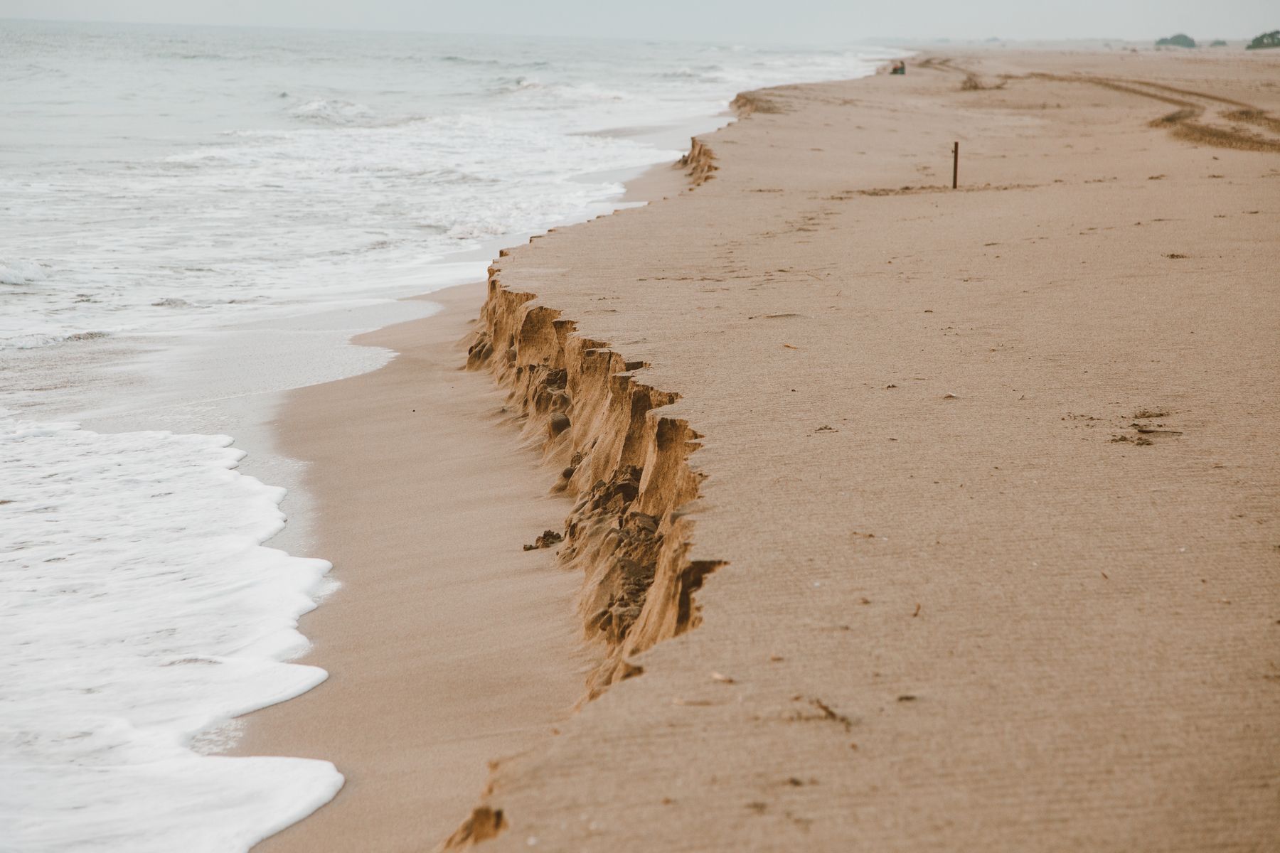
Beach Erosion And Sand Loss
Beach erosion is the net loss of sand from a shoreline over time, driven by wave energy, wind, tides, and sediment supply. Sand loss can be temporary, such as after a storm that reshapes the beach, or persistent when the beach receives less sand than it loses. For visitors, the practical question is not whether sand moves, but when that movement changes access routes, safety conditions, or habitat. A narrow beach during high tide can expose rocks or drop-offs that were hidden in calmer seasons, and that shift can affect swimming, walking, and parking patterns.
Sand loss matters when it changes how the coast behaves for months or years, not just days. Many beaches show seasonal cycles: sand builds in calm periods and shifts offshore during rough weather. The trouble starts when the cycle becomes biased toward loss because sand sources are reduced or wave patterns are altered. Examples include groins that trap sand on one side, dredging that removes nearshore sediment, or seawalls that reflect wave energy and starve the beach downstream.
Local monitoring data often uses shoreline position, beach width, dune height, and sand volume estimates. If you see repeated closures of beach access ramps, increasing exposure of infrastructure, or recurring undercutting of dunes, the sand loss is already affecting real-world use. In some places, the beach is managed as a public asset, so managers track erosion rates and decide when interventions like nourishment are needed. Those decisions depend on budgets, engineering constraints, and environmental rules, not just visible sand gaps.
When Sand Loss Matters Most
Sand loss matters when it affects safety, access, or ecological function in ways that persist beyond a single storm cycle. For safety, look for undercut dunes, exposed roots, collapsing sand at the base of cliffs, and frequent debris lines that move landward. For access, watch for repeated closures of boardwalks, stairs, or parking lots due to shoreline retreat. For ecosystems, erosion can reduce nesting habitat for shorebirds and sea turtles, or it can change how tidal flats and seagrass beds receive sediment.
Timing matters. A beach that loses sand during winter but regains it in summer may still be suitable for visitors, with seasonal caution. A beach that loses sand year after year may require longer-term restrictions, such as limiting access during high tides or relocating facilities. In some regions, managers define triggers like a minimum beach width or a dune crest elevation, then schedule nourishment or temporary barriers when thresholds are crossed.
Measurement helps you judge whether the trend is real. If you can find a local dataset, compare shoreline position across multiple years, not just before-and-after photos. A single measurement after a storm can mislead because storms also change wave direction and water levels. When agencies report rates, they often include uncertainty ranges; those ranges matter when deciding whether change is within normal variability.
As a practical aside, I’ve seen travelers misread a “new” beach after nourishment as proof that erosion is solved. In reality, nourishment projects often use a target volume and grain size, then monitor how quickly sand redistributes. A project completed in 2023 may look stable for a season and then thin during the next high-energy period, which is normal for many coasts and not a sign that the work was fraudulent or ineffective.
Solutions And Advice For Travelers
Use Local Advisories And Closures
Before you go, check the local beach authority website or municipal alerts for closures, turtle nesting zones, and storm damage. If a beach has a posted hazard notice about unstable sand, do not treat it as a minor inconvenience. Follow marked routes and avoid walking on dunes or vegetation, since those areas can be the last line of defense against wave-driven erosion.
When you arrive, look for physical cues that match the advisory: fresh sand slumps, exposed sandbags, or fences that indicate an active erosion front. If you’re traveling with children, choose access points that remain open across tides, not just the easiest-looking entrance. On some coasts, the “safe” route changes with the tide, and the posted map is the only reliable guide.
Track Change With Simple References
If you want to understand whether sand loss is temporary or persistent, compare consistent references across time. Use a fixed landmark such as a pier support, a numbered parking post, or a permanent building corner, then note the waterline position at similar tide stages. A phone photo can help, but record the date and tide time; a photo taken at low tide after a storm can look like a different beach than one taken at high tide on a calm day.
For a more structured approach, some travelers use mapping tools like Google Earth (version history varies) to compare shoreline outlines from different dates. The limitation is resolution: older imagery can be blurry, and cloud cover can hide the shoreline. If you can’t verify the reference quality, treat the comparison as a rough indicator rather than evidence.
Understand Common Management Options
Beach nourishment adds sand to widen the beach, but it does not stop erosion everywhere. The sand can move alongshore, so managers often place it where it will feed the shoreline for a target period. Seawalls and revetments protect land but can increase erosion in front of the structure and reduce natural beach migration. Dune restoration focuses on rebuilding dunes and vegetation, which can reduce overwash during storms but requires ongoing maintenance.
Engineering choices depend on sediment budgets and local wave climate. A nourishment project that works on one stretch may fail nearby if the sand transport direction differs. If you see a pattern of repeated nourishment every few years, that can indicate a managed cycle rather than a permanent fix.
Plan For Safer Access During High Tide
Sand loss often changes the beach profile, which changes where the waterline reaches. Check tide tables from local hydrographic services or reputable meteorological agencies, then plan walks and swimming with a buffer. If the beach has a steep face or exposed sandbars, avoid areas where waves break close to shore, since those zones can intensify rip currents.
Carry footwear with traction and keep a safe distance from eroding edges. If you notice the sand surface collapsing underfoot or you see water cutting channels through the beach, move away and follow the safest route back. This is one of those situations where “it looks firm” can be misleading, especially after recent storm surge.
Educational Case Examples
Scenario A: Seasonal Retreat With Recovery A family visits a temperate coast in late summer. The beach looks narrower than in previous years, but local signage shows that winter storms typically remove sand and summer calm conditions rebuild it. The access stairs remain open, and the dune line is intact. Over the next two weeks, the shoreline position changes with tides but does not show a continuing landward retreat. The family chooses a marked path and avoids the dune edge, and the trip stays focused on recreation rather than safety incidents.
Scenario B: Persistent Loss Near a Protected Segment A couple stays near a shoreline protected by a seawall. During their visit, they notice that the beach in front of the seawall is consistently narrow, while a nearby unprotected stretch has a wider beach. Local updates mention that sediment transport is being interrupted by the structure, shifting erosion down-drift. The beach authority posts periodic warnings about unstable sand near the seawall toe and closes a small access point after storms. The couple adjusts by using the open access route and avoids the closed area, which reduces risk and prevents them from walking into an active erosion zone.
Sand Loss Decision Checklist
| Signal You Can Observe | What It May Mean | How To Respond | When To Escalate |
|---|---|---|---|
| Frequent access closures | Shoreline retreat reaching infrastructure | Use alternate access points and follow posted routes | If closures expand during your stay, leave the area |
| Undercut dunes or exposed roots | Active erosion front and unstable sand | Avoid dune edges; keep to stable, marked paths | If sand collapses underfoot, move away immediately |
| Beach width shrinks year after year | Persistent negative sediment balance | Plan for higher tides and reduced walking area | If authorities post recurring warnings, treat it as a long-term condition |
| Nourishment signs and monitoring markers | Managed cycle, sand redistribution expected | Expect changes after storms; follow seasonal guidance | If sand placed areas are fenced off, do not cross barriers |
Use this checklist as a decision aid, not a substitute for local hazard management. A beach can show one warning sign without indicating a broader trend, so combine observations with official updates.
Common Mistakes To Avoid
One mistake is relying on social media photos without dates, tide context, or location details. A photo posted after a storm can exaggerate erosion severity, while a photo taken during calm weather can hide hazards that appear later. Another mistake is walking close to the toe of dunes or seawalls because the sand looks dry and firm.
People also over-trust “rules of thumb” like “if the sand is smooth, it’s safe.” Sand can be smooth and still be undermined by wave action or hidden channels. If you see water cutting through the beach, that pattern can persist for hours, and it can shift quickly with wind and tide.
Some travelers assume that nourishment means the beach will stay wide for years. Grain size mismatch, wave direction changes, and sediment transport variability can shorten the effective life of a project. If you notice repeated nourishment announcements, treat the beach as managed and expect periodic reshaping.
Finally, avoid stepping into fenced areas marked for habitat protection. Nesting zones and restoration sites often use temporary barriers that look unnecessary until you understand how quickly disturbance can affect breeding success. Even when you feel confident, the safest choice is to follow the boundaries.
FAQ
How can I tell if erosion is temporary or long-term?
Compare shoreline position across multiple dates using official reports or consistent landmarks, and look for repeated patterns such as recurring access closures or year-after-year narrowing rather than a single storm snapshot.
Does a wider beach always mean safer swimming?
Beach width does not predict rip currents by itself. Wave setup, nearshore sandbars, and channels control rip risk, so follow local lifeguard guidance and posted flags.
What measurements do coastal agencies track?
Common metrics include shoreline position, beach width, dune crest elevation, and sometimes sand volume or sediment transport indicators, often derived from surveys, aerial imagery, or satellite mapping.
Can beach nourishment stop erosion permanently?
Nourishment typically delays erosion by adding sand, but it does not remove the underlying sediment imbalance. Sand can redistribute alongshore and offshore, so managers monitor performance and may repeat projects.
Are seawalls and groins always harmful to nearby beaches?
They can protect specific areas while shifting erosion patterns. Effects depend on local sediment transport direction and design, so nearby impacts vary and should be assessed with local studies.
Author's Insight
Beach erosion is a sediment budget problem: sand enters the system from offshore and alongshore transport, and sand leaves through waves, storms, and human alterations. Sand loss matters when it changes hazards, access, or habitat over repeated seasons. Travelers can reduce risk by using official advisories, planning around tides, and treating fenced or unstable areas as active erosion zones. If you want to judge trends, look for multi-year shoreline data rather than single photos, since storms can temporarily reshape beaches in ways that reverse later.
Key Takeaways
- Sand movement is normal; sand loss matters when it persists across seasons and affects safety or access.
- Use official closures and hazard notices as your primary source of guidance.
- Beach width alone does not predict rip currents; nearshore conditions and lifeguard advice matter.
- Nourishment and coastal structures can change where erosion occurs, so expect reshaping even after interventions.
- Compare multi-year shoreline indicators when possible, and plan walks with tide context and a buffer.