Subsurface Urban Legacies
Modern municipal engineering owes its structural foundations to the subterranean networks developed in antiquity. Ancient urban centers were not merely collections of monumental architecture; they were complex, multi-tiered systems reliant on integrated infrastructure layers. The durability of these networks allowed cities like Rome, Alexandria, and Angkor to sustain populations exceeding several hundred thousand residents within confined geographic footprints.
To analyze these ancient urban environments, civil engineers apply a layered diagnostic framework similar to modern Geographic Information Systems (GIS). Infrastructure is split into three primary tiers: the subterranean hydrological layer, the subterranean waste transport layer, and the surface logistics layer. When these systems functioned in unison, they created a resilient urban metabolic cycle capable of absorbing environmental shocks and population surges.
Empirical evidence from archaeological excavations demonstrates that the failure of an ancient city was rarely caused by sudden military conquest alone. More frequently, a city's decline stemmed from the gradual degradation of its infrastructure layers, such as the siltation of water channels or the collapse of waste management conduits. Understanding the load bearings, materials, and hydraulic gradients used by ancient builders provides critical context for contemporary sustainable urban design.
Infrastructure System Failures
The primary error in interpreting ancient civil engineering is treating public works as isolated monuments rather than interdependent networks. When a civilization failed to integrate its freshwater delivery with its wastewater removal, the result was systemic failure. Water stagnation, soil salinization, and systemic pathogens frequently compromised urban density before external threats could manifest.
In many ancient cities, builders overlooked the long-term impact of sedimentation. Without mechanical dredging or built-in flush mechanisms, horizontal conduits quickly filled with silt, reducing volumetric flow rates by up to 60% within a generation. This issue was particularly acute in civilizations that relied on gravity-fed earthworks without lining their channels with hydraulic mortar or fired brick.
Furthermore, the improper management of the surface logistics layer often choked the subterranean networks. Heavy vehicular traffic, such as iron-shod wagons, generated localized ground vibrations that cracked unreinforced terracotta piping buried beneath the pavement. This structural damage led to cross-contamination between clean water inflows and effluent discharge, rendering entire quarters of a city uninhabitable due to waterborne crises.
Engineering the Three Tiers
Hydraulic Mortar Innovation
The Roman development of pozzolanic concrete (opus caementicium) revolutionized the subterranean infrastructure layer. By mixing volcanic ash from Mount Vesuvius with lime and seawater, Roman engineers created a material that hardened underwater through a chemical reaction that formed aluminum-tobermorite crystals. This structural characteristic allowed for the construction of waterproof aqueduct channels and massive cisterns.
In practice, this material allowed the Aqua Claudia to transport approximately 184,000 cubic meters of water daily over a distance of 69 kilometers. The inner channel, or specus, was lined with this hydraulic mortar, maintaining a precise gradient of roughly 1:300. This deliberate slope prevented high-velocity erosion while ensuring the water velocity remained high enough to avoid stagnation and bacterial growth.
Subterranean Effluent Control
Wastewater management reached a historical pinnacle with Rome's Cloaca Maxima. Originally constructed as an open-air canal to drain the marshy valleys between the hills, it was enclosed in the 2nd century BCE with a massive barrel vault made of three concentric rings of tufa stone blocks, laid without mortar. This subterranean conduit accepted both stormwater runoff and sewage from public latrines.
The engineering genius lay in its self-cleaning design. The Cloaca Maxima utilized the natural hydrological flow of the Tiber River's tributaries. During periods of heavy rainfall, the increased water volume scoured the bottom of the main channel, preventing the accumulation of solid waste. This integrated system maintained a structural equilibrium that has kept parts of the vault functional for over two millennia.
Baray Earthwork Logistics
The Khmer Empire at Angkor utilized an entirely different infrastructural approach, relying on massive surface-level earthworks known as barays. The West Baray, measuring 8 kilometers in length and 2.1 kilometers in width, was constructed by mounding earth rather than excavating it. This immense artificial lake held up to 53 million cubic meters of water during the peak of the empire.
This hydrological layer served a dual purpose: flood mitigation during the intense monsoon season and irrigation distribution during the dry season. A complex network of lateral canals and overflow weirs distributed water across thousands of hectares of rice paddies. The precision of the earthen dikes, constructed with specific slope profiles to prevent liquefaction, shows an advanced grasp of geotechnical engineering concepts.
Pre-Ceramic Drainage Systems
In South America, the ancient city of Caral (dating to 3000 BCE) demonstrates that sophisticated infrastructure predates the invention of ceramics or metal tools. Located in the Supe Valley of Peru, Caral’s architects engineered a surface and subsurface drainage network using stones contained within woven plant-fiber bags called shicras. These flexible structures provided excellent seismic resistance.
To manage the rare but devastating flash floods common to the arid region, Caral featured stone-lined channels that diverted torrential runoff away from the sacred pyramidal structures and residential zones. The placement of these channels utilized the natural topography, directing water into adjacent agricultural fields. This early form of water harvesting prevented structural erosion while maximizing localized soil moisture.
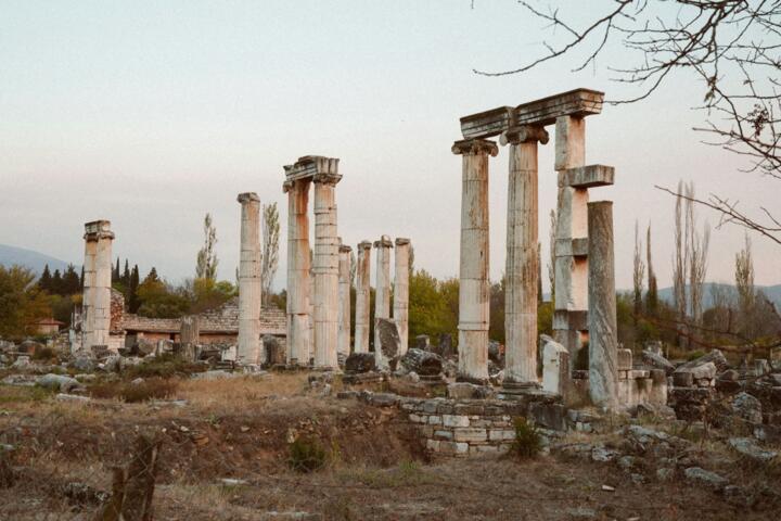
Siphon Aqueduct Physics
The Hellenistic Greeks solved the problem of crossing deep valleys without building massive stone arch bridges by mastering inverted siphons. At Pergamum, engineers constructed a lead pipeline that spanned a valley 200 meters deep to deliver water to the city’s acropolis. The system relied on the principle of communicating vessels, where water seeks its own level.
Operating under pressures exceeding 20 bars, the Pergamum siphon required flawless joints and robust anchoring. Engineers anchored the pipe joints into heavy stone blocks to prevent blowouts caused by the water's kinetic energy changes at the valley floor. This infrastructure layer allowed the city to grow vertically on a defensive hilltop while maintaining a steady, high-pressure clean water supply.
Urban Metabolism Analysis
A comparative look at the infrastructure of ancient Alexandria reveals the quantifiable impact of integrated planning. Founded by Alexander the Great and expanded by the Ptolemies, the city featured a grid system with a subterranean layer composed of hundreds of interconnected brick cisterns. These cisterns were filled annually by the Nile flood via the Canopic canal branch.
Data from recent underwater and subterranean surveys indicate that Alexandria's cistern network could store up to 1 million cubic meters of freshwater. This volume was sufficient to sustain a population of 300,000 residents for up to a year during blockades or low Nile flows. The system worked because the surface logistics layer—the wide, paved streets—was sloped to funnel rainwater directly into the settling basins preceding the cisterns.
When this sediment-trapping layer was systematically cleaned, the water quality remained exceptionally high. However, when municipal budgets shifted away from infrastructure maintenance in the late Byzantine period, sediment buildup reduced the system's capacity by 45%. This reduction triggered a localized population decline, demonstrating the strict correlation between infrastructural volume and urban demographic caps.
Infrastructure Specifications
| City | Primary Material | Core Tier | Capacity Metric |
|---|---|---|---|
| Rome | Pozzolan Concrete | Subterranean Hydraulic | 1.1M m³ daily |
| Angkor | Compacted Laterite | Surface Hydrological | 53M m³ storage |
| Pergamum | Lead and Stone | Inverted Siphon | 20 bar pressure |
| Caral | Shicra Vegetable Bag | Seismic Drainage | Flash flood shift |
Avoid Design Anachronisms
When analyzing ancient civil networks, modern engineers often make the mistake of assuming these systems operated with the same closed-loop logic used today. Ancient systems were largely open or linear, relying on the natural carrying capacity of adjacent ecosystems to absorb waste. Projecting modern environmental criteria backward can lead to incorrect conclusions about the efficiency of ancient designs.
Another error is ignoring local material availability when assessing structural choices. For instance, the absence of stone aqueducts in Mesopotamian cities like Babylon was not due to a lack of engineering knowledge, but rather a lack of localized stone quarries. Babylonians maximized their clay deposits, engineering highly advanced bitumen-lined brick conduits that achieved similar hydraulic goals.
Finally, always account for human intervention in maintenance cycles. An ancient infrastructure layer was only as good as the labor force assigned to maintain it. The collapse of the Roman curation boards (cura aquarum) in the 4th century CE led to immediate structural degradation across the network, despite the physical resilience of the pozzolanic concrete itself.
FAQ
How did they check grades?
Roman engineers used a chorobates, a 20-foot wooden straightedge with a water channel along the top for leveling. They also used a dioptra, an early form of the transit level, to calculate precise angles and slopes over long, challenging distances across varied terrain.
Was lead poison common?
While lead was used in Roman plumbing, regular poisoning was minimized by the high calcium content of the water. This mineral content deposited a thick layer of limestone scale (calcium carbonate) inside the pipes, effectively coating the metal and isolating it from the water flow.
How did they clear silt?
Systems featured settling basins, called piscinae limariae, at regular intervals along aqueduct routes. These wider chambers slowed the water's velocity, allowing suspended sand and silt to drop to the bottom before the water entered the main urban delivery pipes.
Did they have valves?
Yes, ancient Roman plumbing utilized sophisticated bronze stopcocks and wipe-joint valves. These heavy bronze components allowed workers to isolate specific branches of the distribution network for maintenance or to shut off water to non-paying industrial users.
How were works funded?
Large infrastructure projects were funded via military spoils, imperial treasury allocations, or elite civic patronage (euergetism). Wealthy citizens funded public works like baths or fountains to secure political influence and cement their social standing within the community.
Author's Insight
In my field research surveying ancient Mediterranean hydraulic systems, I have always been struck by the sheer scale of the safety factors used by ancient builders. They did not design for a 50-year storm event; they built for centuries of unpredictable environmental shifts. My primary takeaway for modern urban planners is to embrace this philosophy of material honesty and structural redundancy. Relying on complex, energy-dependent electronic valves is far less resilient than utilizing gravity, slope, and self-healing pozzolanic materials.
Summary
The infrastructure layers of ancient cities demonstrate an intimate understanding of civil engineering, materials science, and fluid dynamics. By treating fresh water delivery, waste disposal, and surface logistics as an integrated system, ancient societies built resilient urban hubs. The core lesson for modern municipal development is clear: prioritize long-term structural durability over short-term financial savings. Re-engineering modern systems to include natural gradients and self-scouring channels can reduce maintenance overhead and improve city resilience.