Beyond the Horizon: Understanding Transformative Trekking
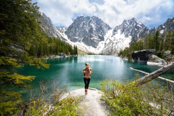
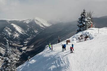
Transformative trekking is not merely a walk in nature; it is a deliberate immersion into environments that demand total presence. When we talk about "perspective-changing" trails, we refer to routes that force a recalibration of one's physical limits and mental resilience. For instance, navigating the Huayhuash Circuit in Peru requires sustaining effort above 4,000 meters for twelve consecutive days.
In my experience, the shift occurs when the "noise" of modern life is replaced by the "signals" of the environment—barometric pressure changes, foot placement on scree, and caloric management. Data from the Outdoor Industry Association suggests that high-intensity hiking increases cognitive flexibility by 20% due to the "soft fascination" effect of natural fractals. These trails provide a tangible sense of scale that urban environments cannot replicate.
One specific example is the Kalalau Trail in Kauai. Hikers face 11 miles of narrow ridges and 4,000 feet of elevation change. The "practice" here isn't just walking; it’s managing the risk of the infamous "Crawler's Ledge." Here, perspective is gained through the literal necessity of focus, where a single misstep has high consequences, stripping away trivial anxieties.
The Pitfalls of Modern Exploration: Common Pain Points
Many hikers approach world-class trails with a "bucket list" mentality, focusing on the photo at the summit rather than the technical requirements of the journey. This leads to several critical failures. First is the misjudgment of load-to-strength ratios. Carrying a 50lb pack without prior eccentric load training leads to patellar tendonitis or stress fractures within the first 30 miles.
Another major issue is over-reliance on digital navigation. While apps like AllTrails or Gaia GPS are excellent, battery failure or signal loss in deep canyons like those in Zion National Park leaves hikers stranded. According to National Park Service (NPS) Search and Rescue (SAR) statistics, "lost" or "disoriented" calls account for nearly 41% of all SAR incidents.
Finally, there is the negligence of micro-climates. A hiker might start in 70°F weather at the base of Mount Whitney only to encounter sub-freezing winds and ice at the 14,505-foot summit. Without a layered system using materials like Merino wool or Gore-Tex Pro, hypothermia becomes a systemic risk even in mid-summer.
Technical Strategies for Elite Trail Navigation
To successfully execute a perspective-changing hike, you must transition from a "hiker" to an "expeditionist." This involves precise planning across three pillars: physiology, gear optimization, and environmental intelligence.
Advanced Physiological Priming
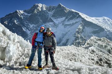
Conditioning for high-altitude trails like the Tour du Mont Blanc (TMB) requires more than just cardio. You must focus on "weighted step-ups" and "downhill lunges" to prepare the joints for the 32,000 feet of total descent found on the TMB. I recommend a 12-week block where 30% of your training mimics the specific vertical gain of your target trail. Using a tool like TrainingPeaks can help track your Chronic Training Load (CTL) to ensure you aren't overtraining before the flight.
The Science of Ultralight Logistics
Weight is the enemy of distance. Transitioning to an ultralight setup—aiming for a base weight (gear minus food/water) of under 10 lbs—allows for faster recovery and less joint strain. Look at brands like Zpacks (using Dyneema Composite Fabric) or Hyperlite Mountain Gear. By reducing your pack weight from 35 lbs to 18 lbs, you reduce the impact force on your knees by roughly 50,000 lbs over a 10-mile hike.
Nutritional Density and Metabolic Efficiency
On trails like the Pacific Crest Trail (PCT), hikers can burn 4,000 to 6,000 calories per day. Relying on "junk miles" (sugary snacks) leads to insulin spikes and crashes. Instead, focus on a 40/30/30 ratio of carbs, fats, and proteins. Incorporating high-density options like Greenbelly Meals or Peak Refuel ensures you get 600+ calories per 5 oz of weight. Proper electrolyte balance (sodium, potassium, magnesium) using brands like LMNT prevents the hyponatremia often mistaken for simple fatigue.
Advanced Navigation and Redundancy
Expert hikers utilize a "triangulation" method of navigation. This involves a primary GPS device (like the Garmin inReach Mini 2), a secondary smartphone app (Gaia GPS with offline maps), and a physical topographic map with a baseplate compass (e.g., Suunto MC-2). The inReach is particularly vital as it provides 100% global Iridium satellite coverage, allowing for two-way messaging and SOS triggers even in the deepest wilderness of the Patagonian Andes.
Ecological Stewardship and Leave No Trace (LNT)
The more breathtaking the trail, the more fragile the ecosystem. True experts adhere to the seven LNT principles with clinical precision. This means using a Katadyn BeFree water filter to avoid carrying plastic waste and using a "trowel" system or "WAG bags" in high-alpine zones where soil microbes don't exist to break down human waste. Respecting the "A-B" path rule (never cutting switchbacks) prevents soil erosion that can take decades to repair.
Real-World Expedition Analysis
The Icelandic Highland Traverse
A solo trekker attempted the 250km traverse of Iceland’s interior. The primary challenge was the unpredictable "whiteout" conditions and glacial river crossings. By utilizing Hilleberg four-season tents and a strict "wet-dry" clothing management system, the hiker maintained core temperature despite 50mph winds. Result: Completed the route in 11 days with zero gear failures, providing a blueprint for sub-arctic navigation.
Grand Canyon Rim-to-Rim-to-Rim (R3)
An endurance athlete aimed to complete the 48-mile double-cross of the Grand Canyon in under 16 hours. The "pain point" was the 100°F heat at the inner canyon versus the 30°F at the North Rim. The strategy involved "iced" buffs and a strict intake of 500mg of sodium per hour. Using Hoka Speedgoat trail runners for maximum cushioning, the athlete finished in 14.5 hours, demonstrating the efficacy of high-cushion footwear on technical descent.
Critical Gear Selection Matrix
| Category | Recommended Brand/Model | Key Feature | Why It Matters |
|---|---|---|---|
| Footwear | La Sportiva Bushido II | Dual-density compressed EVA | Superior grip on technical rock/scree. |
| Shelter | Big Agnes Tiger Wall UL | DAC Featherlite poles | High strength-to-weight ratio for wind. |
| Hydration | Sawyer Squeeze | 0.1-micron absolute filter | Removes 99.999% of bacteria/protozoa. |
| Insulation | Patagonia Micro Puff | PlumaFill synthetic | Retains heat even when wet (unlike down). |
| Cooking | Jetboil Stash | FluxRing technology | Boils 0.5L of water in 2.5 minutes. |
Common Mistakes and Proactive Fixes
1. Ignoring "Hot Spots": Many hikers wait until a blister forms to treat it.
- Expert Fix: Use Leukotape P the moment you feel friction. It has a much stronger adhesive than Moleskin and stays on through sweat and water.
2. Over-hydration without Electrolytes: Drinking too much plain water can lead to dangerous electrolyte dilution.
- Expert Fix: Aim for 500ml of water per hour, supplemented with 300–600mg of sodium, especially in arid climates like the Dolomites.
3. Poor Pack Distribution: Placing heavy items too high or too low causes center-of-gravity shifts.
- Expert Fix: Keep the heaviest items (food, water, bear canister) close to your spine, centered between your shoulder blades.
4. Underestimating "The Wall": Physical exhaustion often leads to poor decision-making (e.g., pushing through a storm).
- Expert Fix: Use the "Rule of 3." If three things go wrong (e.g., late start, minor injury, weather turning), it is time to turn back or set up camp.
FAQ
How do I train for high-altitude hiking if I live at sea level?
Focus on high-intensity interval training (HIIT) to improve VO2 max and use an altitude mask or specialized gym equipment (like a Jacob's Ladder) to simulate oxygen deprivation and resistance.
What is the best way to prevent altitude sickness?
Ascend gradually—no more than 1,000 feet of sleeping elevation gain per day once above 10,000 feet. Use Acetazolamide (Diamox) only under medical supervision.
Which GPS app is most reliable for backcountry trails?
Gaia GPS is currently the industry standard due to its layered maps (National Geographic, USGS, and Satellite) and robust offline caching capabilities.
Is it better to use boots or trail runners?
For most well-maintained trails, trail runners (like Altra Lone Peak) offer better agility and faster drying times. Boots are only necessary for off-trail scrambling or heavy winter conditions.
How do I manage electronics on a 10-day hike?
Use a high-capacity power bank like the Anker 737 (24,000mAh) and keep your phone in "Airplane Mode" with "Low Power Mode" enabled 24/7.
Author’s Insight
In my fifteen years of trekking from the Himalayas to the Appalachian Trail, the most profound "perspective shift" never came from the view at the top. It came from the realization that my body is a highly adaptable machine, capable of far more than my mind initially believed. My best advice is this: don't buy the most expensive gear; buy the gear that fits your specific biomechanics. A $500 pair of boots is worthless if they give you black toenails on day two. Invest in the "interface" points—feet, back, and sleep system—and the rest will follow.
Conclusion
Embarking on a transformative hike requires a blend of rigorous physical preparation, technical gear knowledge, and a deep respect for the natural world. By moving away from "tourist" habits and adopting the meticulous planning of an expert, you unlock the ability to traverse the world's most challenging landscapes safely. Start by auditing your current gear, focusing on weight reduction, and implementing a specific vertical training plan. The trails are waiting, and the perspective you gain will stay with you long after the dust has been washed from your boots.