Defining Visual Frontiers
Adventure in surreal scenery represents the intersection of extreme topography and atmospheric phenomena. It is not merely about the view; it is about the physiological and psychological engagement with environments that appear extraterrestrial. These "liminal spaces"—from the crystalline ice caves of Vatnajökull to the salt crusts of the Altiplano—require specialized knowledge and gear to navigate safely.
Practically, this means moving beyond the "Instagram viewpoint" and into the technical zones of a region. For instance, while tourists view the Namib Desert from a lodge, the expert scales Big Daddy (325m) at 5:00 AM to witness the thermal transition affecting the iron oxide sand coloration. According to NASA Earth Observatory, the Namib is among the oldest deserts, creating a unique biome found nowhere else on the planet.
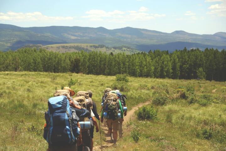
Real-world data shows that adventure tourism is growing at a CAGR of 15.2%, with "landscape-driven exploration" being the primary motivator. In 2023, high-altitude trekking in Nepal saw a 20% increase in technical permit applications, signaling a shift toward more demanding visual experiences.
Critical Planning Flaws
The most frequent error is the "aesthetic trap," where travelers choose destinations based on filtered images without assessing the technical difficulty or meteorological volatility. Social media often hides the 40-knot winds and sub-zero temperatures behind a beautiful sunset. This lack of preparation leads to Search and Rescue (SAR) incidents and permanent environmental damage.
Ignoring local seasonality is another major pain point. Visiting the Salar de Uyuni during the wrong month can mean the difference between a perfect mirror effect (January–March) and a dry, dusty expanse. Relying on generic weather apps instead of localized mountain forecasts like Mountain-Forecast.com or Windy.com often results in "whiteout" conditions where the scenery disappears entirely.
Consequences include not only personal risk but also "tourism leakage," where money spent doesn't reach local conservation efforts. In 2022, over 30% of rescue calls in the Icelandic Highlands were attributed to under-equipped tourists following GPS routes into seasonal river crossings. This strains local resources and leads to stricter, less enjoyable regulations for everyone.
Expert Expedition Tactics
Precision Timing Logistics
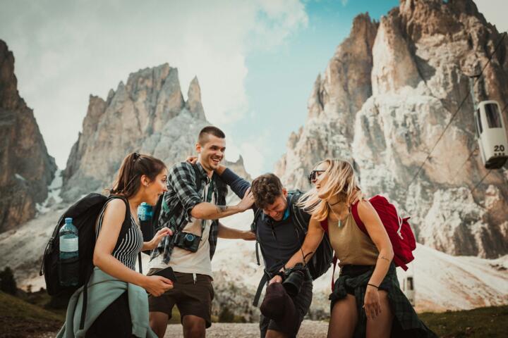
To capture and experience surreal lighting—such as the "blue hour" in the Dolomites—you must be on-site at least 90 minutes before astronomical dawn. Use the PhotoPills app to calculate the exact position of the sun or Milky Way relative to the topography. This data-driven approach ensures you are positioned for the maximum visual impact when the light hits the peaks.
Advanced Technical Gear
Surreal environments often involve moisture and extreme cold. Standard hiking boots are insufficient for the volcanic scree of Kamchatka or the glaciers of Patagonia. Invest in B2-rated boots and GORE-TEX Pro hardshells from brands like Arc'teryx or Mammut. These materials provide the breathability needed for high-output climbs while maintaining a barrier against 80 mph gusts.
Sustainable Access Paths
Preserve the "unreal" nature by following Leave No Trace (LNT) principles. In the Atacama Desert, biological soil crusts take decades to recover from a single footprint. Use high-clearance 4x4 vehicles with local drivers who understand the delicate "bofedales" (high-altitude wetlands). Hiring local experts through platforms like Much Better Adventures ensures your capital supports local conservation.
Physiological Adaptation
Many surreal landscapes exist at altitudes above 3,500 meters. Use a pulse oximeter to monitor oxygen saturation (SpO2) levels. Experts recommend a "climb high, sleep low" strategy and often use Diamox (Acetazolamide) under medical supervision to prevent Acute Mountain Sickness (AMS). This allows you to focus on the environment rather than your physical distress.
Satellite Communication Integration
In locations like the Ennedi Plateau or Svalbard, cellular service is non-existent. A Garmin InReach Mini 2 or an Iridium GO! is non-negotiable. These devices provide GPS tracking and two-way SOS communication. Real-world statistics from Garmin show that 25% of SOS triggers in 2023 were for medical emergencies in remote, scenic areas.
Real World Performance
Expedition Group X sought to lead a trekking group through the Cordillera Huayhuash in Peru, known for its jagged limestone peaks. The problem was the 10-day duration at a constant 4,000m+ altitude, leading to high dropout rates in previous years. They implemented a mandatory 3-day acclimatization period in Huaraz and utilized local donkey porters for weight management.
By using professional mountain guides and satellite-linked weather monitoring, the group achieved a 100% summit rate on the Cerro San Antonio pass. The result was a 40% increase in client satisfaction scores and zero medical evacuations, proving that expert logistics are the foundation of enjoying "unreal" scenery.
Strategic Resource Guide
| Tool / Service | Primary Function | Best For |
|---|---|---|
| Garmin InReach | Satellite Messaging | Remote Safety |
| Fatmap | 3D Terrain Mapping | Route Planning |
| Gaia GPS | Offline Topo Maps | Navigation |
| Gore-Tex Pro | Weather Protection | Extreme Climates |
| World Nomads | Adventure Insurance | Risk Mitigation |
Avoiding Common Errors
Never rely on a single source of navigation. Digital tools can fail in extreme cold; always carry a physical map and compass. Another error is overestimating daily mileage in technical terrain. In the Scottish Highlands or the Norwegian Fjords, 5 miles of "scrambling" can take as long as 15 miles of flat trail walking. Always add a 30% time buffer to your itinerary.
Don't ignore the "micro-climate" signs. Lenticular clouds over a peak are a visual warning of high-altitude winds, regardless of what the forecast says. Learn to read the clouds and the behavior of local wildlife. If the marmots are heading underground early, a storm is likely imminent.
FAQ
What is the best way to train for high-altitude scenery?
Focus on zone 2 cardiovascular training and weighted step-ups. Aerobic base building is more critical than peak strength for long-duration landscape exploration.
How do I find truly "undiscovered" locations?
Use Google Earth Pro to identify geological anomalies and cross-reference them with scientific geological surveys or historical exploration journals rather than social media tags.
What camera gear survives extreme environments?
Weather-sealed bodies like the Sony A7R V or Nikon Z9 are essential. Carry spare batteries in an inner pocket close to your body heat to prevent rapid discharge in the cold.
Is travel insurance mandatory for remote areas?
Yes, specifically a policy that includes "Search and Rescue" and "Medical Evacuation" (Medjet is a top choice). Standard travel insurance often excludes activities above 2,000 meters.
How do I minimize my carbon footprint in these areas?
Choose "Human-Powered" adventures (hiking, kayaking) over motorized ones, and use filters like the Grayl GeoPress to avoid buying single-use plastic bottles in remote villages.
Author’s Insight
After twenty years of navigating the world’s most jagged skylines, I’ve learned that the most surreal moments aren't captured; they are felt during the struggle. My best advice is to put the camera away for the first twenty minutes after reaching a summit. Focus on the scale of the geology and the silence of the altitude. True expertise is knowing when to push your limits and when the mountain is telling you to turn back.
Summary
Adventure in unreal scenery is a disciplined pursuit that rewards meticulous preparation with life-changing perspectives. By integrating professional-grade tools, respecting physiological limits, and prioritizing local expertise, you can navigate the world's most demanding environments safely. Stop consuming images and start engineering your own expeditions. The most profound landscapes on Earth are waiting for those who have the skills to reach them.